Map Search Button 
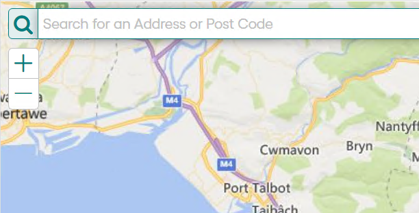
Locations, addresses, and post codes can be searched for by clicking the Search button.

What's Going On Here 
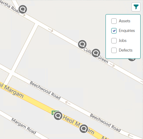
When zoomed in to a location nearby entities can be shown by clicking the What's Going On Here button at the top right of the map and selecting the options from the list. The entities will refresh as the map is moved.

Entities are included according to the following rules:
- Features are restricted by Device Data Key Security on the Feature Group (see the Feature Group lookup in the Confirm desktop client).

- Enquires will be displayed that have been created or updated in last six months.

- The Job is scheduled to start in the next thirty days.
- Or the Job has been completed within the last year.
- Or the Job has not been completed but some activity has been performed on it within the last year and the Job has not been archived.
- For Contractor users, the Job must also be at a Job Status with the 'Available to Contractor' flag ticked.

- Defects will be displayed if they are not superseded, and are not set to 'No Action Required'.
Map Filter Button 
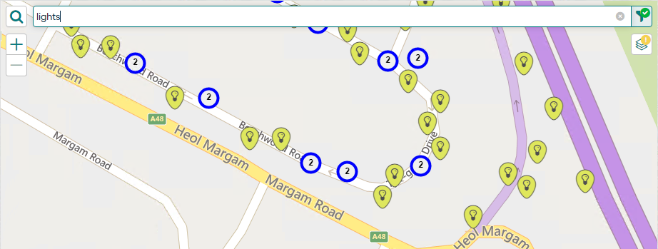
The 'What's Going On Here' results can be filtered by the following:
- Feature ID
- Feature Group
- Feature Type
- Job Number
- Type
- Status
- Description
- Location
- Enquiry Number
- Subject
- Service
- Location
- Defect Number
- Type
- Location
- Priority

Current Entity Button 
When viewing the Map on the Job, Defect, or Feature screen, this button will pan/zoom the map to the current Job, Defect, or Feature respectively.
Drawing Tool Palette 
On the Job screen, the Drawing Tool Palette allows the geo-location and geometry of the Job to be edited. The Drawing tools support point, line, and polygon geometries.
Click the pencil button to open the Drawing Tool Palette and select the Point, Line, or Polygon drawing tool.
Clicking the 'X' button to clear the current geometry.
Nodes can be added to a line geometry by clicking on the required position on the line. Similarly, nodes can be added to a polygon geometry by clicking on any edge.
Nodes can be removed by clicking on them.
To draw free-hand, hold down the 'shift' button on your keyboard while drawing.
Aerial Map Button 
Click the Aerial Map button to change the background map to the 'aerial' map, as configured on the Web Settings screen.
Road Map Button 
Click the Road Map button to change the background map to the 'roads' map, as configured on the Web Settings screen.
Info Popup
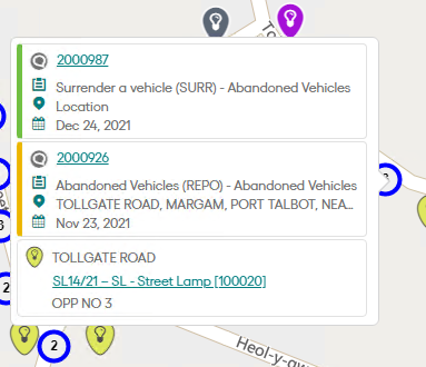
Clicking on any item on the map will display the Info Popup.
The Info Popup displays the following details:
- Site
- Feature ID (if available)
- Type
- Plot Number
- Job Number
- Job Type
- Status
- Target/Actual Completion Date
- Enquiry Number
- Status
- Description (or Subject if Description not available)
- Location (or Site if Location not available)
- Logged Date
- Defect number
- Defect Type
- Defect Creation Date
If more than one entity is at same location, a cluster is displayed in that location, with the count of overlapping entities.
